A Technical Prospectus
A different kind of digital place
Most digital systems begin with people: accounts, identities, profiles, relationships, permissions and activity. Place, when it appears, is usually context—a location attached to something else.
The Ward begins somewhere else.
Place is the primary object.
The Ward starts by constructing the place itself. Everything else—people, businesses, events, exchanges—belongs to that place.
That choice shapes the technology.
IWhat it’s made from
We start with what’s already there.
A neighborhood does not have to be invented from scratch.
We begin with what we can learn about the place: public data and records, direct observation, and information from the neighborhood itself. Streets, parcels, buildings, elevation and trees give us a foundation; local knowledge fills in what the records cannot.
Cartograph brings those sources together and turns them into a working model of the neighborhood.
The source material is only the beginning.
The work is in making sense of it: reconciling different sources, filling gaps, correcting what needs correcting, and making the information agree with the place.
Some of the foundation is already there. Streets, buildings, elevation, land cover, and other large-scale geographic data can be drawn from open datasets.
Other information belongs to the place. Parcels, zoning, trees, historic designations, and similar records come from the agencies and institutions that maintain them.
The rest comes from the neighborhood itself. Businesses, menus, photographs, landmarks, names, habits, and the details that distinguish one place from another.
IIHow a place is made
Cartograph
Cartograph is the environment used to construct a digital place.
It begins with geographic information and ends with a working model of the neighborhood.
First we build the place. Then we turn the lights on.
The Ward spends complexity upstream so the experience downstream can remain simple. Each step inherits a result, not the complexity that produced it.
Survey — draw the place
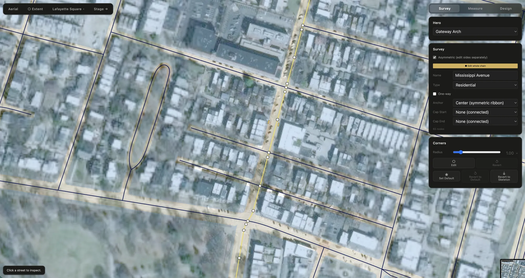
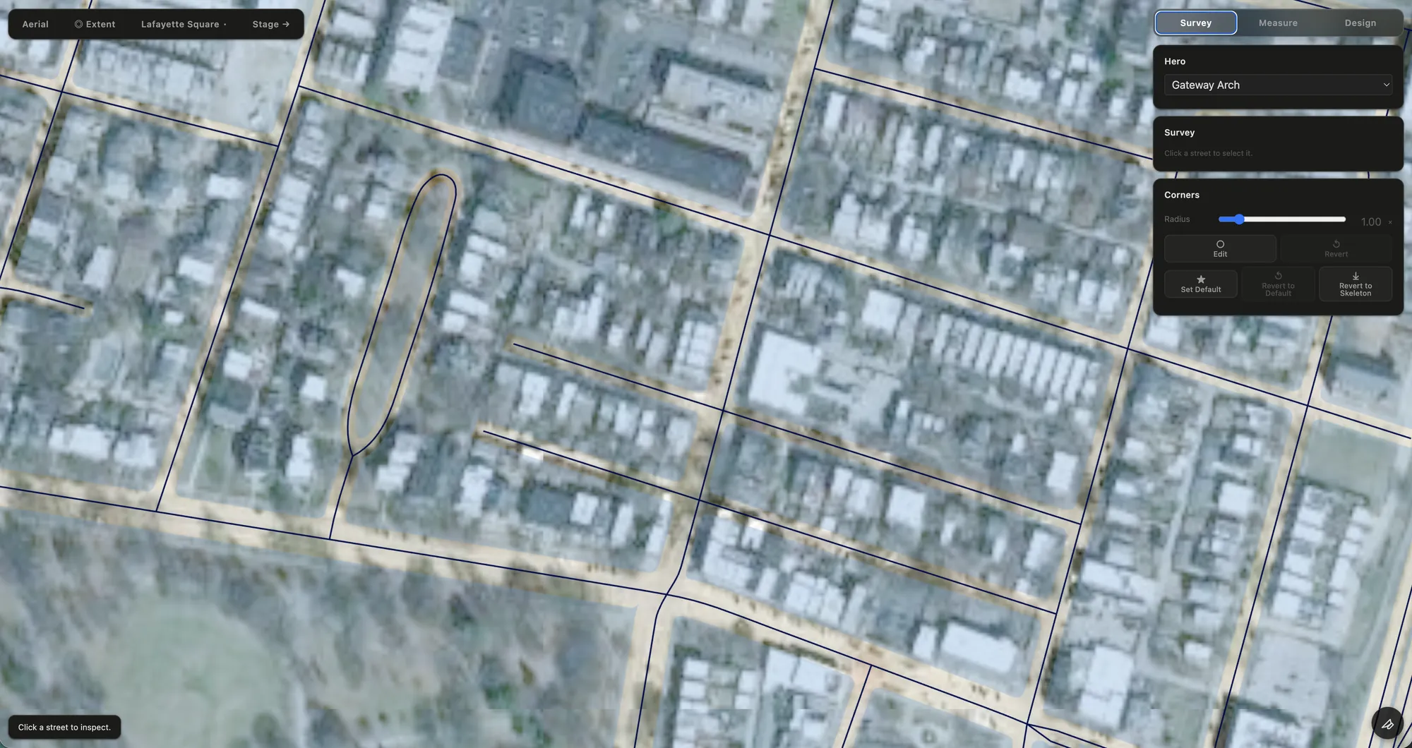
Most digital maps are made to help you find something or get somewhere. They can simplify, standardize and omit much of the physical character of a place because that character isn’t necessary to the job.
Survey has a different job. It builds a map meant to be looked at: one where the shape of a block, the sweep of a curb and the particular geometry of a street are part of the picture.
Section — build the ground
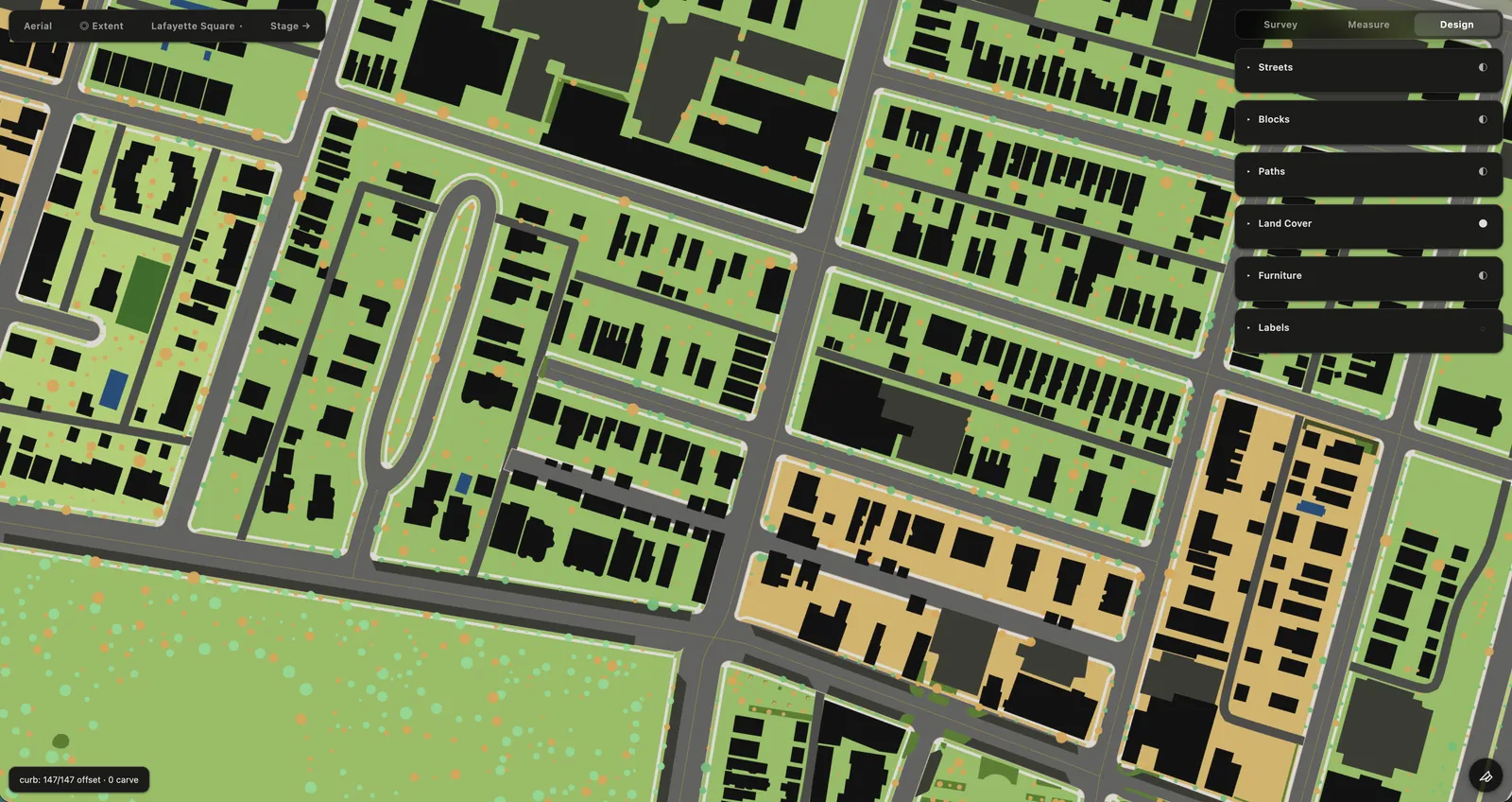
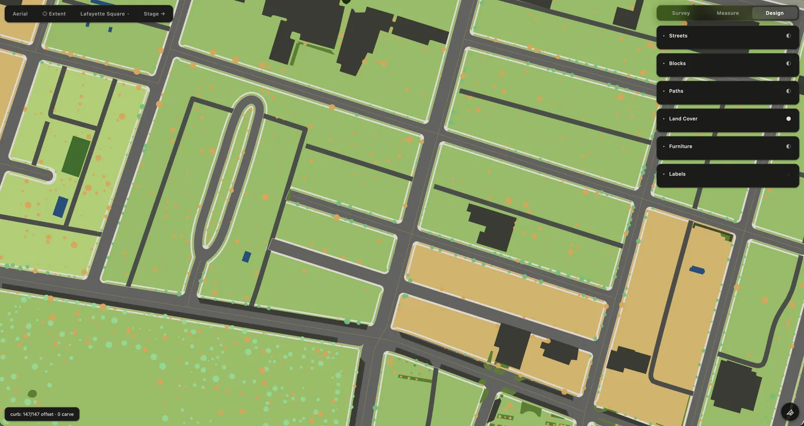
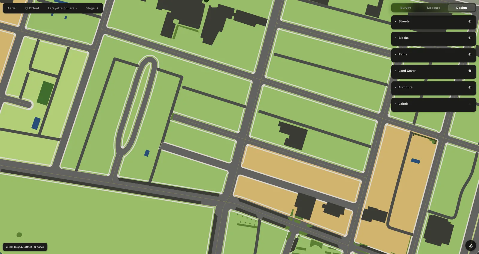
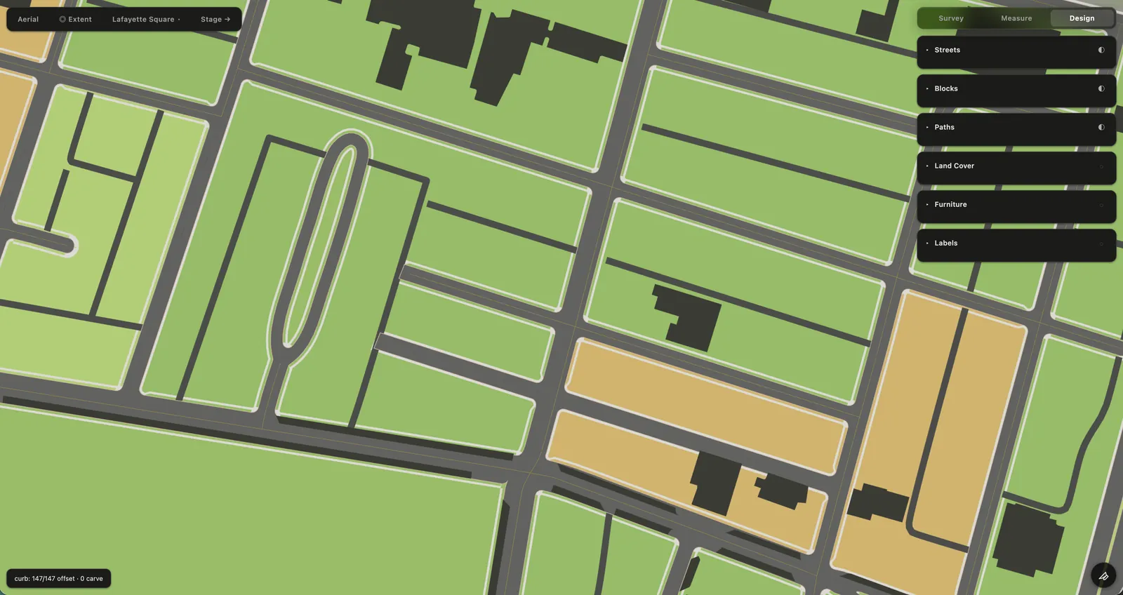
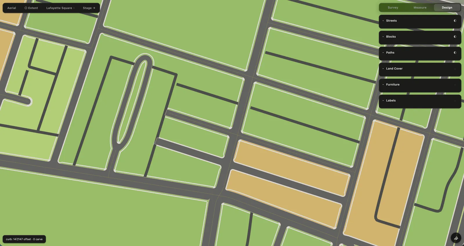
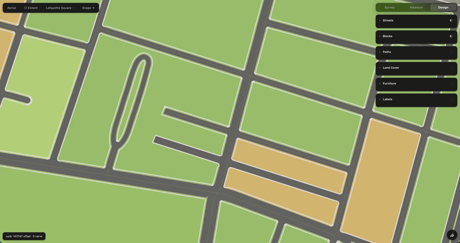
With the street plan established, Section builds the ground around it: sidewalks, treelawns, accessible corners, setbacks, and the other elements that give each block its physical structure.
It begins with the best available information, then gives the operator the tools to make it agree with the place.
2D construction Bake into 3D 3D authoring
Stage — light the place
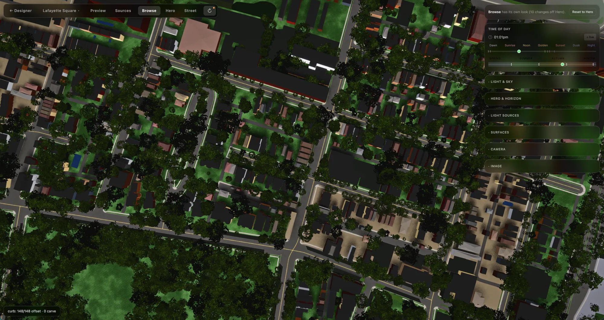
The resolved place becomes a 3D environment. Its geometry is settled; now the operator authors materials, light, sky, atmosphere, cameras and the neighborhood’s changing appearance across the day.
The tools are closer to cinema and real-time graphics than conventional cartography. A Look can change continuously from dawn through daylight, golden hour, dusk and night.
Form and function are finally friends.
Authoring Bake for runtime The Slab
Preview — prove the place
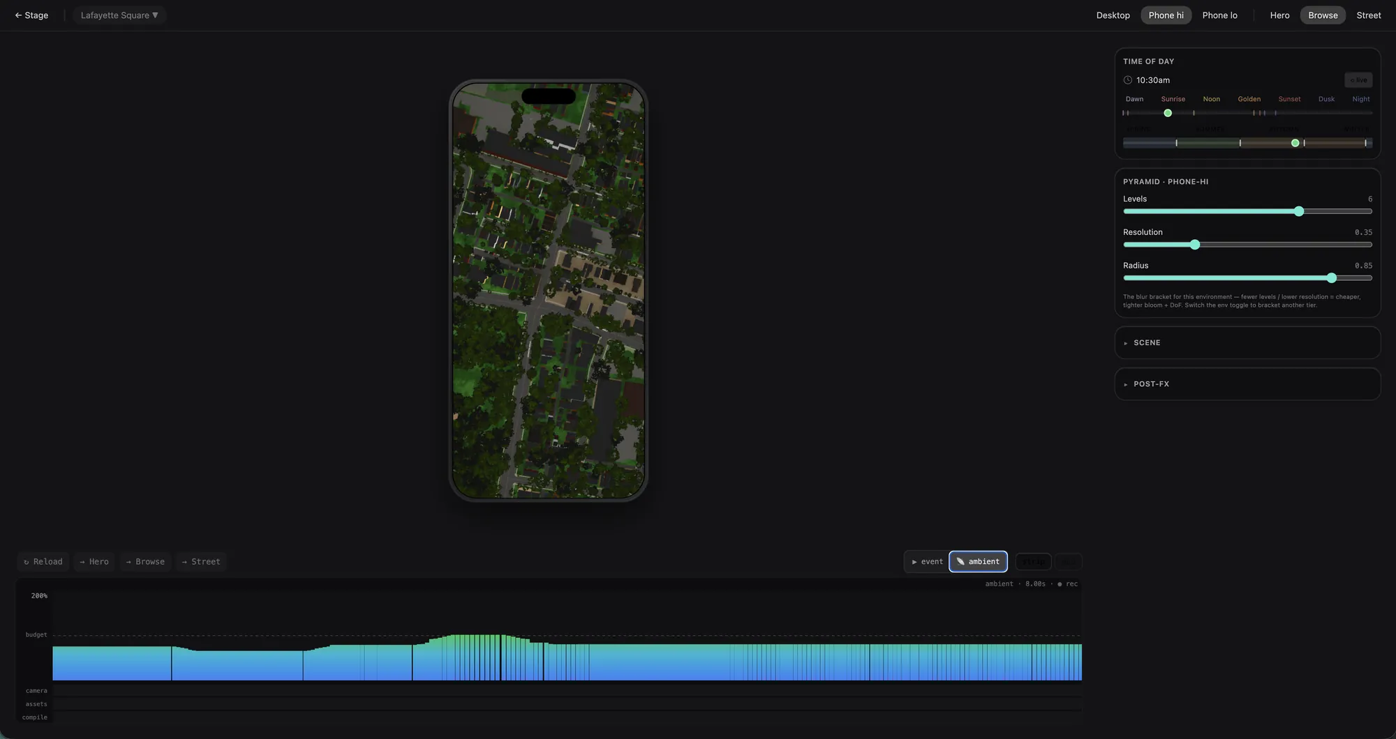
Preview is Cartograph’s own testing environment. Every Slab is different, but the things that need testing are predictable.
It brings those tests together: GPU load, frame time, individual layers, camera states, different moments of the day, and the other conditions that determine how a Slab performs in production.
Aesthetics and performance are co-equal and non-negotiable.
The Slab — what ships
The Slab is the condensed result of that process. It contains what the runtime needs, rather than the systems and reasoning that produced it.
By the time a place reaches the browser, the work of constructing it is finished.
Arborist and Meteorologist are being built as resources in their own right. The Ward is their first client, not necessarily their last.
IIIWhat that buys
The population is already there
A Ward does not enter a neighborhood and then acquire its users one by one. It begins with the place—and the people, businesses and institutions already there belong to it.
Place changes the economics
That changes the economics. A new service does not begin by building a market from zero; it enters a place that already has one.
Cary is The Ward’s delivery module, and it routes the money. Orders and delivery fees come in throughout the day. At the end of the day, the money is split: the full price of the order goes to the business, most of the delivery fee goes to the neighbor who carried it, and a small amount stays with The Ward.
Place changes the data problem
The Ward can know a great deal about a neighborhood without knowing very much about the people using it.
Person-level information can therefore be reserved for the functions that actually require it.
When place is the primary object, people do not have to become data merely to make the place useful.
Commissioned Programs
The Ward can host temporary commissioned experiences. An artist might create a seasonal Look; a sponsor might fund a scavenger hunt through neighborhood Places; a film, museum, or festival might create a trail, exhibition, or other experience across the real neighborhood.
A sponsor can buy something for the neighborhood. It cannot buy the neighborhood. Programs confer no right to target participants, receive participant-level data, build advertising profiles, or buy placement in ordinary neighborhood surfaces.
The system already saves Looks, making artist takeovers largely possible today: a commissioned Look can change color, atmosphere, post effects, curb and leaf silhouettes without altering the underlying Ward. The cartographer makes the place right; the artist makes it special. Place-based Programs can instead be built on Places, verified presence, standing, and geography as their medium.
Programs create revenue distinct from Cary: contributors can be paid and a funder can underwrite more than a Program costs, with the remainder supporting the Ward—without taking more from merchants or Couriers, charging residents to participate, or selling participant information. A Program can disappear when it ends while its authorship remains part of the Ward’s record.
Neighborhood mobility
A proposed extension of Cary for passenger trips originating within a Ward and traveling beyond its boundary. The initial St. Louis concept anticipates service from participating neighborhoods to destinations throughout the city and county, with the Ward providing the local point of origin and third-party transportation infrastructure providing the ride.
The same architecture could accommodate local mobility partners, bikeshare, transit, or rideshare differently from city to city.
Beyond St. Louis
Early work is underway in Altadena and on Cape Cod, testing how the system translates to places with different geography, character, institutions, and local data.
New York footprint
.online addresses have been reserved across major New York City neighborhoods as a prospective metropolitan network.
View domains
- astorianyc.online
- bayridge.online
- bedstuy.online
- boroughpark.online
- brownsvillenyc.online
- bushwicknyc.online
- canarsie.online
- carrollgardens.online
- chelseanyc.online
- chinatownnyc.online
- coneyisland.online
- crownheights.online
- dykerheights.online
- eastflatbush.online
- eastharlem.online
- eastnewyork.online
- eastvillagenyc.online
- flatbushnyc.online
- ftgreene.online
- gramercy.online
- harlemnyc.online
- lesnyc.online
- longislandcity.online
- lowereastside.online
- meatpacking.online
- midtownnyc.online
- midwood.online
- murrayhill.online
- northbronx.online
- northbrooklyn.online
- parkslope.online
- prospectheights.online
- sheepsheadbay.online
- southbronx.online
- southbrooklyn.online
- uesnyc.online
- unionsquarenyc.online
- uwsnyc.online
- washingtonheights.online
- westvillagenyc.online
Build with The Ward
The next step is more places.
That means partners who can help bring a Ward to a neighborhood, strengthen the underlying technology, develop the standalone instruments, or provide the infrastructure and capital to take the system further.